Malaria
 Malaria has distinct
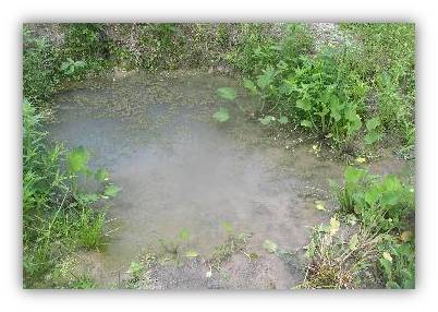
environmental drivers. Rainfall defines the
transmission season by provided breeding sites
for the mosquitoes that are the vectors of the
disease, while temperature impacts both the
vector larva and adult lifecycles. Many other
environmental factors play a role, from soil
type and terrain topography which affect the
surface hydrology, as well as the land cover
type. Socio-economic factors should not be
neglected. Interventions can depress
transmission or eradicate it altogether in a
region, but population migration can
reintroduce the disease. Understanding what
drives malaria transmission in this complex
web of factors could be aided by accurate
models of the disease transmission that
operate over regional scales.
Malaria has distinct
environmental drivers. Rainfall defines the
transmission season by provided breeding sites
for the mosquitoes that are the vectors of the
disease, while temperature impacts both the
vector larva and adult lifecycles. Many other
environmental factors play a role, from soil
type and terrain topography which affect the
surface hydrology, as well as the land cover
type. Socio-economic factors should not be
neglected. Interventions can depress
transmission or eradicate it altogether in a
region, but population migration can
reintroduce the disease. Understanding what
drives malaria transmission in this complex
web of factors could be aided by accurate
models of the disease transmission that
operate over regional scales.
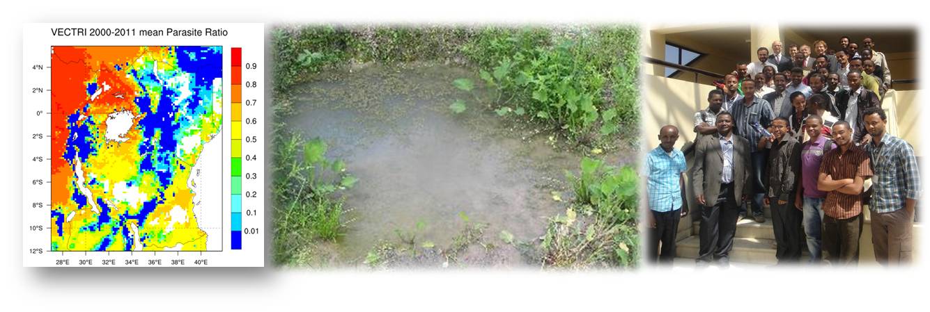
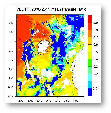
VECTRI Malaria Model
 VECTRI is a mathematic dynamical
model for malaria transmission that accounts for the impact of
climate variability and population. It was written in the
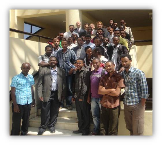
early period of 2011 and officially launched at the second
workshop for East Africa Climate and impacts at the university
of Addis Ababa in November 2011. The underlying aim of the
model is to provide a research tool to understand what drives
malaria transmission that can be applied on a regional scale
but at spatial resolutions of 10km or less.
THE DOCUMENTATION IS CURRENTLY BEING UPDATED AND
MIGRATED TO GITHUB.IO - DURING THIS PROCESS THE ONLINE
DOCUMENTATION IS FROZEN AND SOMEWHAT OUT OF DATE. PLEASE HAVE
PATIENCE AND WE AIM TO RELEASE THE NEW PLATFORM IN SUMMER 2023.
VECTRI is a mathematic dynamical
model for malaria transmission that accounts for the impact of
climate variability and population. It was written in the
early period of 2011 and officially launched at the second
workshop for East Africa Climate and impacts at the university
of Addis Ababa in November 2011. The underlying aim of the
model is to provide a research tool to understand what drives
malaria transmission that can be applied on a regional scale
but at spatial resolutions of 10km or less.
THE DOCUMENTATION IS CURRENTLY BEING UPDATED AND
MIGRATED TO GITHUB.IO - DURING THIS PROCESS THE ONLINE
DOCUMENTATION IS FROZEN AND SOMEWHAT OUT OF DATE. PLEASE HAVE
PATIENCE AND WE AIM TO RELEASE THE NEW PLATFORM IN SUMMER 2023.
What is new in VECTRI?
 VECTRI attempts to incorporate a simple but physically based
treatment of surface hydrology, and more importantly it
accounts for the population density when calculating biting
rates and transmission probabilities. This is important,
since it allows the model to represent the difference in
transmission rates between rural and peri-urban locations.
Moreover, the link to population means that the model can be
actively developed to incorporate immunity, migration,
socioeconomic status, urbanisation and interventions. It does
this in a framework that allows regional or even
continental-wide simulations.
VECTRI attempts to incorporate a simple but physically based
treatment of surface hydrology, and more importantly it
accounts for the population density when calculating biting
rates and transmission probabilities. This is important,
since it allows the model to represent the difference in
transmission rates between rural and peri-urban locations.
Moreover, the link to population means that the model can be
actively developed to incorporate immunity, migration,
socioeconomic status, urbanisation and interventions. It does
this in a framework that allows regional or even
continental-wide simulations.